Our tour is stopped in the Naxi City of Jiliang which is now a major tourist attraction for one major reason, Joe Rock. This morning, we are introduced to city guide Wu the local expert who will escort us to Yunshangping, the village where Joe Rock lived for many years. He came to Yunshangping in 1926.

His house is similar to this one. Entrance through a courtyard surrounded by buildings on three sides. It contains garden plants, and hay for the animals.

The animals are housed directly across from the personal residence.

The middle building upstairs is like a granary, where crops are stored. Beneath tools, and other needful items are stored. This is obviously the dwelling of an affluent family. Joe Rock’s house is now owned by a “Dandy” who keeps up the house and a small museum with some pictures of Joe Rock. He has strict rules about pictures. You pay for each one and he dresses up and poses in them. I took one picture of him at Joe Rock’s house.

Perhaps in his own way, he is a colorful man for this area, but, Joe Rock was a legend. An American anthropologist/botanist who traveled and studied extensively in Asia. He was the first Westerner to meet the Naxi. They were not friendly to outsiders but Joe Rock brought and gave them medicine and gained their trust. He was very fat and he hired Chinese men to carry him on a special chair like some royal Egyptian out of a Hollywood Movie. He wrote several books and lived in this village for many years while he examined, photographed and studied their pictographic language, and translated it into a written language. He preserved the culture of the old-timers before they died and the language became lost. He photographed their rituals and studied their culture extensively as well as local plants, medicinal practices, their music and dance; their textiles and calligraphy. His character is interesting and so are the Naxi. It is worth a look at this website. .http://factsanddetails.com/china.php?itemid=172&catid=5&subcatid=87#11

Yunshangping sits below the Eastern Himalayan Mountains with a view of the snow capped peaks in the distance. Wu tells us the Naxi in this village do not like to have their picture taken so we try to capture them surreptitiously.

Most of the houses are made from this beautiful volcanic rock and wood. We are walking the main thoroughfare of the village which isn’t very big, guessing that maybe 1000 people live here.

This Naxi man is leading a Chinese tourist on a horse.

The bright blue cap and garb is traditional Naxi clothing worn by everyone.

A Naxi grandma surrounded with her grandchildren enjoyed watching tourists like Michal, befriending this pony.

We saw many of these small pony’s around town.

A mountain stream runs through the middle of town, their source of fresh water.

We noticed a couple men cooking on outdoor braziers. The dog is very obedient and the Naxi love their pets according to Wu.

Children play in the streets which see very little vehicle traffic. People walk or ride horses.

Clothing, washed by hand, like cooking, done outside.

We hated to leave this peaceful village, but we pushed on higher up the mountain to Hanzai.

His house is similar to this one. Entrance through a courtyard surrounded by buildings on three sides. It contains garden plants, and hay for the animals.

The animals are housed directly across from the personal residence.

The middle building upstairs is like a granary, where crops are stored. Beneath tools, and other needful items are stored. This is obviously the dwelling of an affluent family. Joe Rock’s house is now owned by a “Dandy” who keeps up the house and a small museum with some pictures of Joe Rock. He has strict rules about pictures. You pay for each one and he dresses up and poses in them. I took one picture of him at Joe Rock’s house.
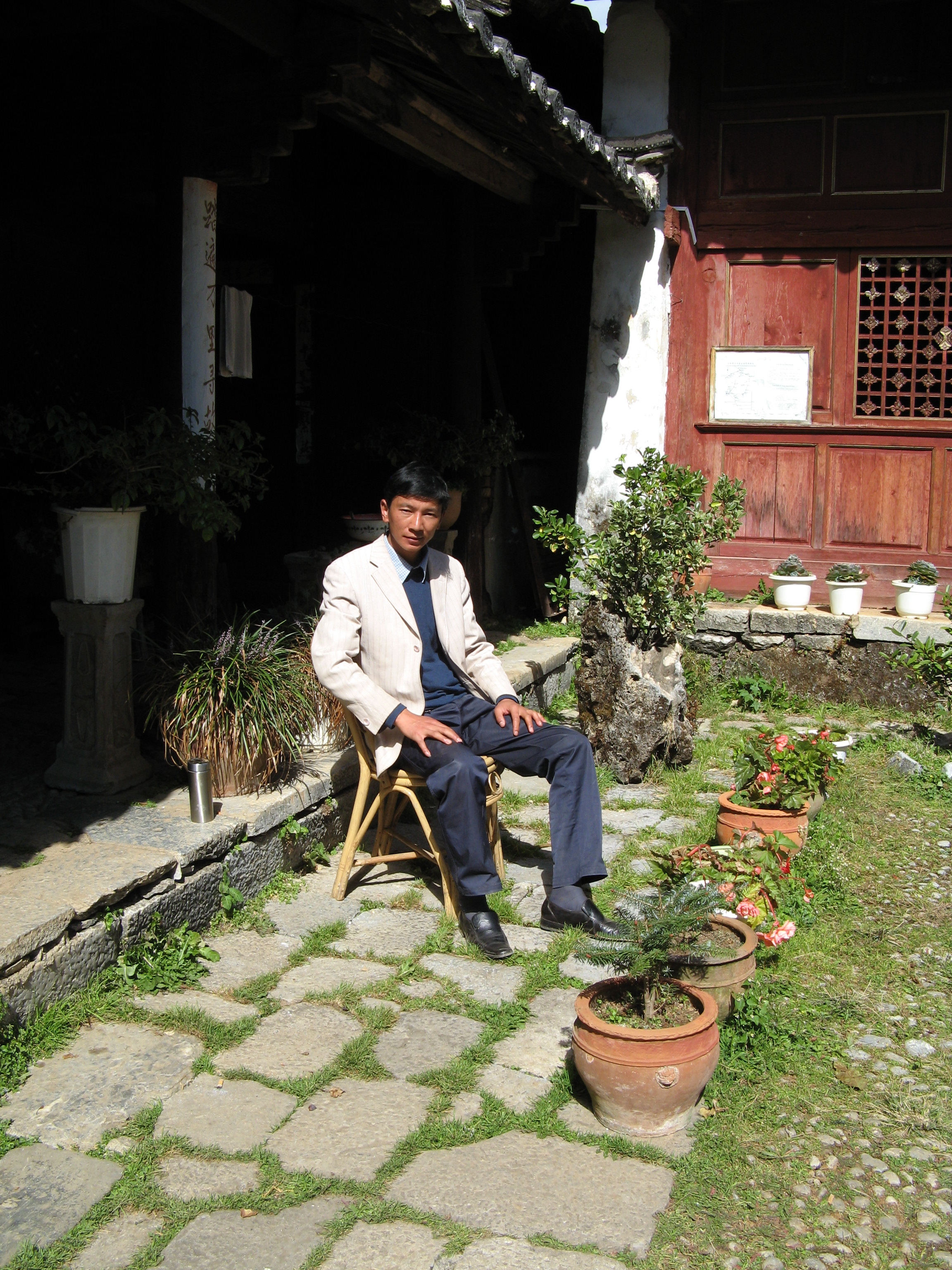
Perhaps in his own way, he is a colorful man for this area, but, Joe Rock was a legend. An American anthropologist/botanist who traveled and studied extensively in Asia. He was the first Westerner to meet the Naxi. They were not friendly to outsiders but Joe Rock brought and gave them medicine and gained their trust. He was very fat and he hired Chinese men to carry him on a special chair like some royal Egyptian out of a Hollywood Movie. He wrote several books and lived in this village for many years while he examined, photographed and studied their pictographic language, and translated it into a written language. He preserved the culture of the old-timers before they died and the language became lost. He photographed their rituals and studied their culture extensively as well as local plants, medicinal practices, their music and dance; their textiles and calligraphy. His character is interesting and so are the Naxi. It is worth a look at this website. .http://factsanddetails.com/china.php?itemid=172&catid=5&subcatid=87#11
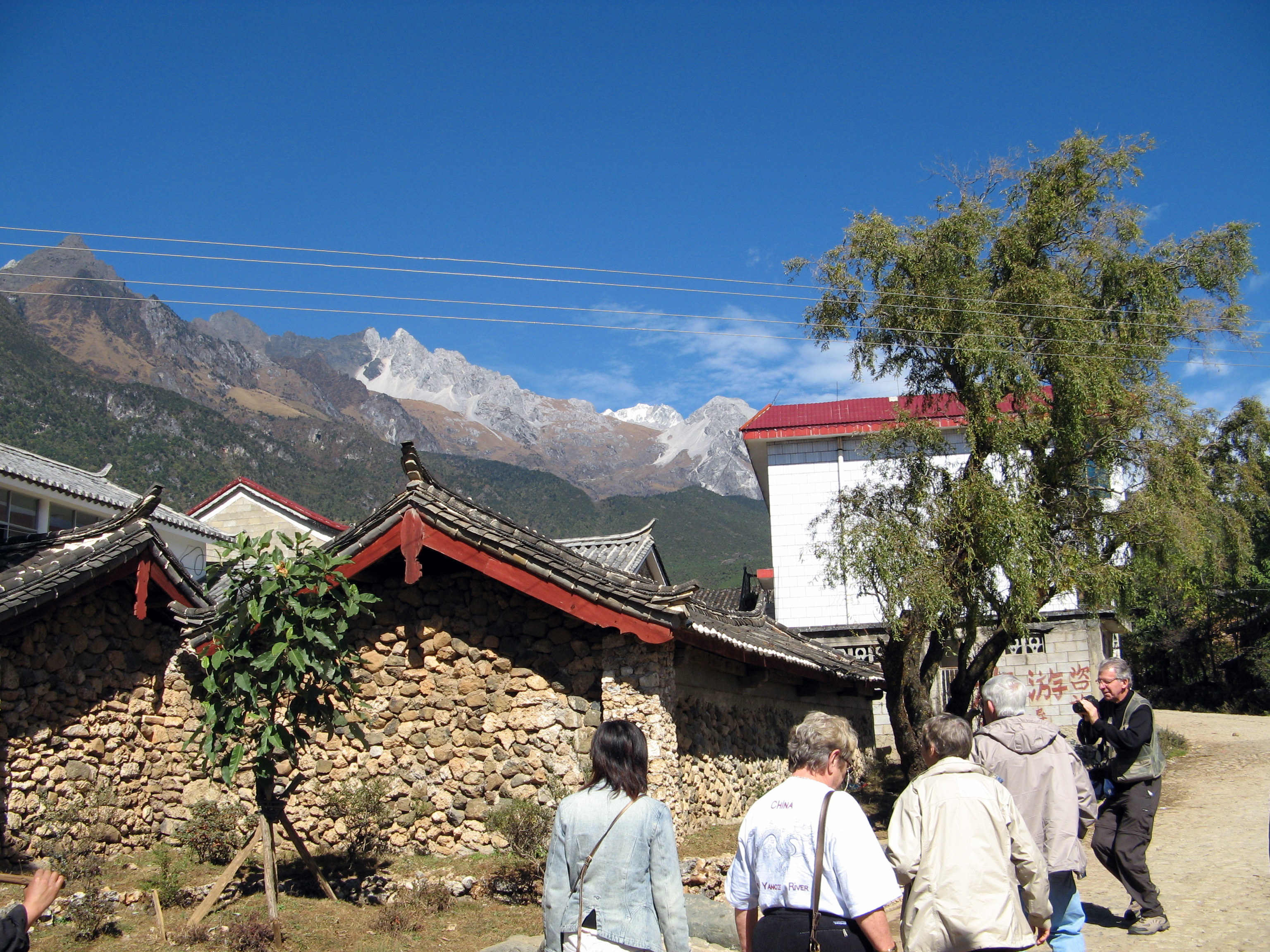
Yunshangping sits below the Eastern Himalayan Mountains with a view of the snow capped peaks in the distance. Wu tells us the Naxi in this village do not like to have their picture taken so we try to capture them surreptitiously.
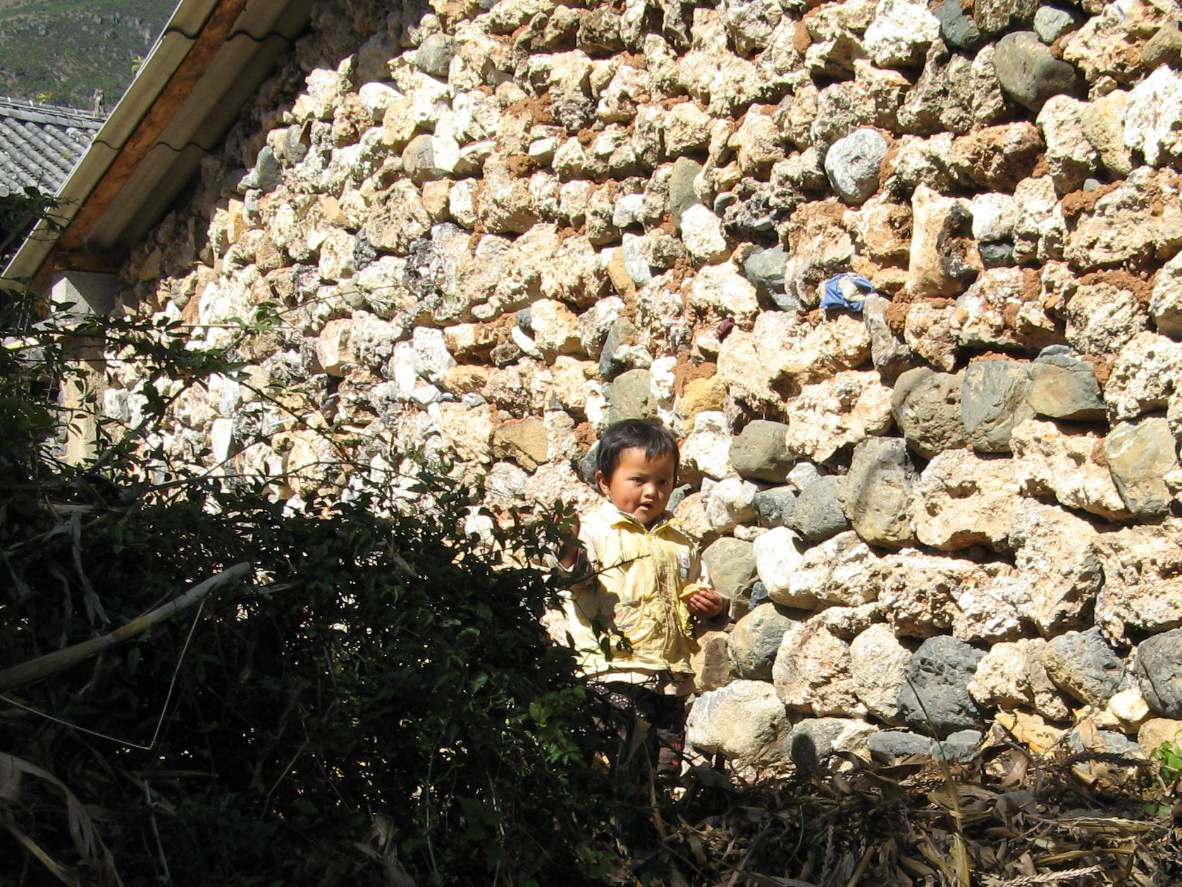
Most of the houses are made from this beautiful volcanic rock and wood. We are walking the main thoroughfare of the village which isn’t very big, guessing that maybe 1000 people live here.

This Naxi man is leading a Chinese tourist on a horse.
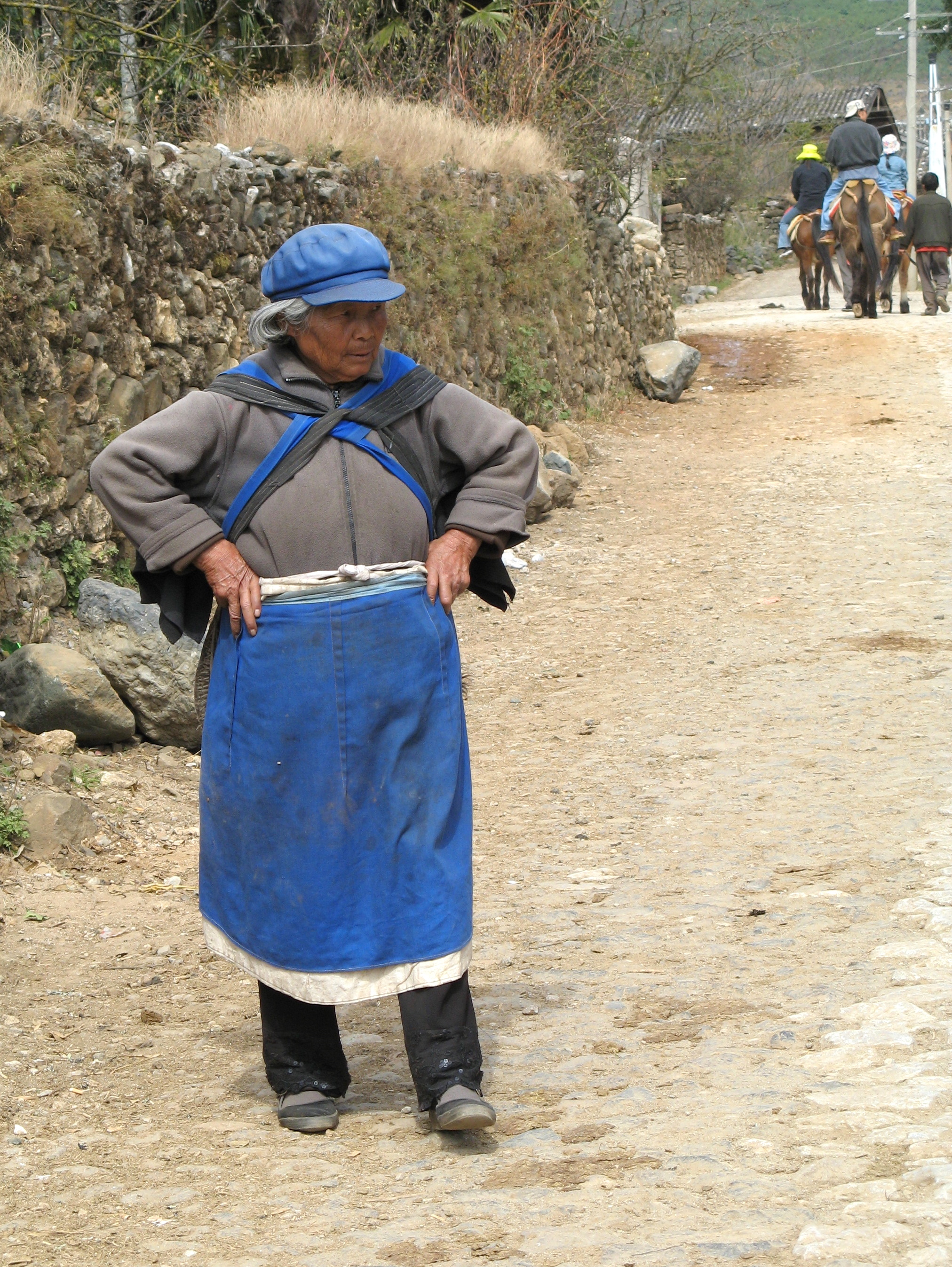
The bright blue cap and garb is traditional Naxi clothing worn by everyone.

A Naxi grandma surrounded with her grandchildren enjoyed watching tourists like Michal, befriending this pony.

We saw many of these small pony’s around town.
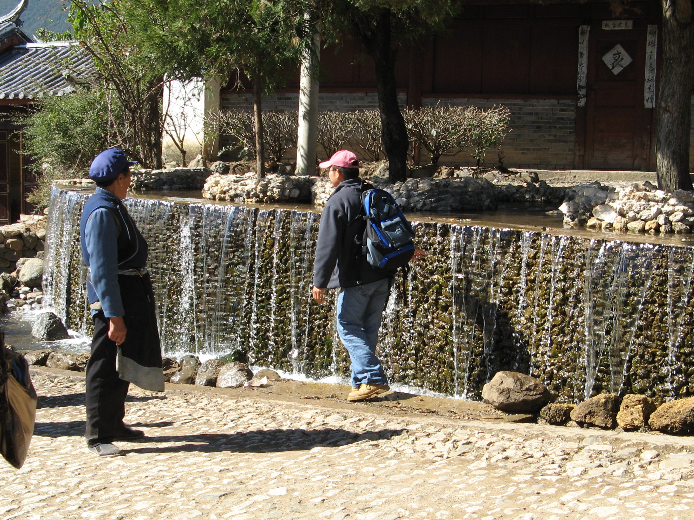
A mountain stream runs through the middle of town, their source of fresh water.
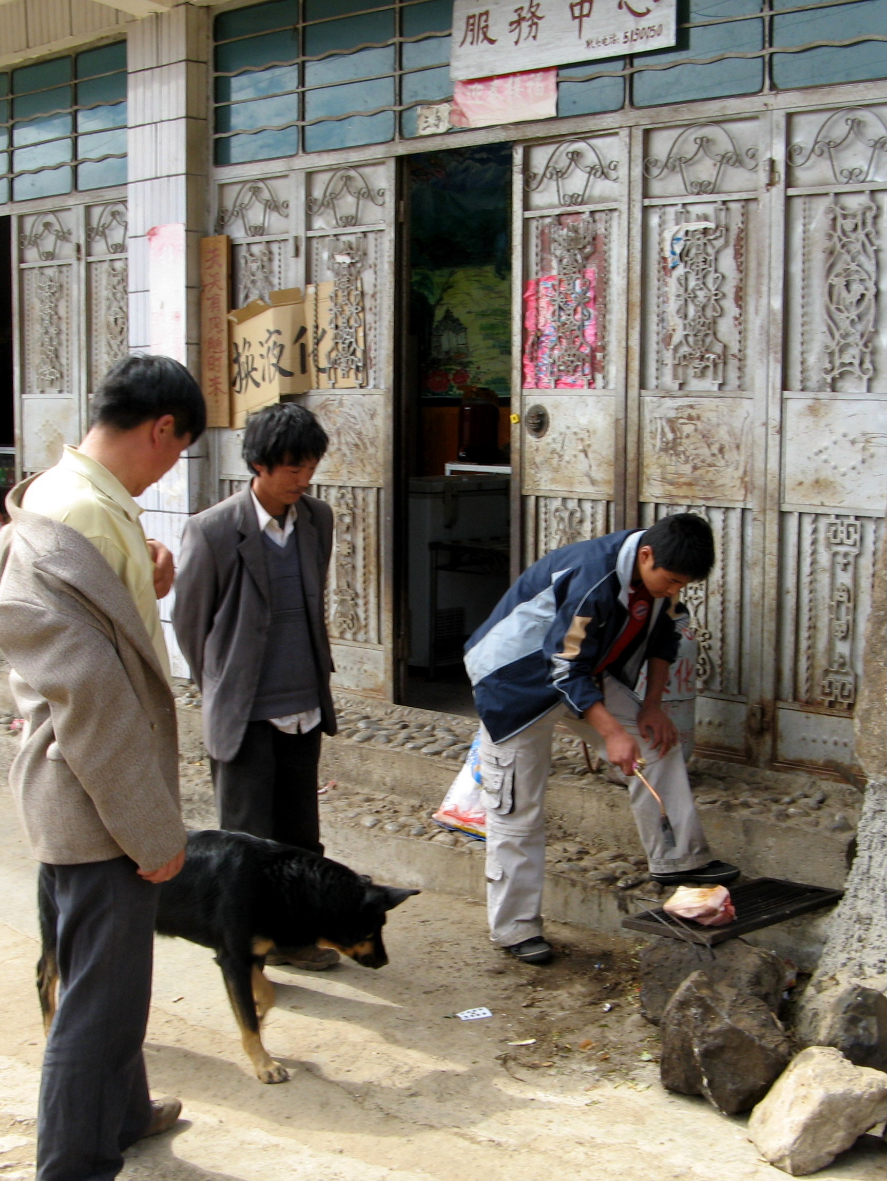
We noticed a couple men cooking on outdoor braziers. The dog is very obedient and the Naxi love their pets according to Wu.

Children play in the streets which see very little vehicle traffic. People walk or ride horses.
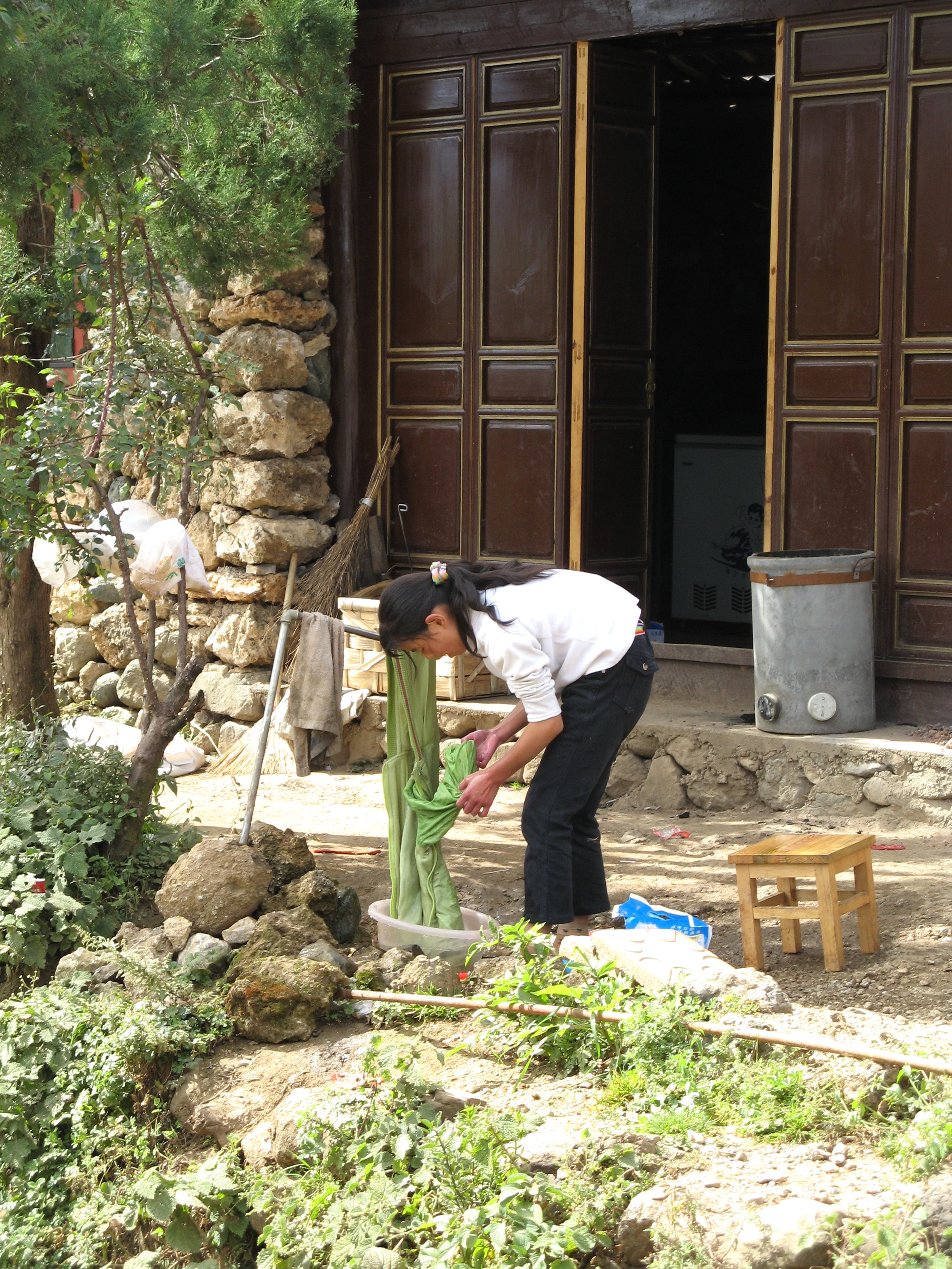
Clothing, washed by hand, like cooking, done outside.

We hated to leave this peaceful village, but we pushed on higher up the mountain to Hanzai.