Showing posts with label Lewis And Clark. Show all posts

Thursday, September 12, 2013

SHELBY, CUT BANK, BIG SKY MONTANA

DSC00242 (Copy)
They call Montana Big Sky country, obvious when you drive the treeless plains.  The morning we departed Chinook, the sky was beautiful.  I wished I could have been out on the open road to see it.
DSC00247 (Copy)
Highway 2 presents you a lot of big sky and golden or green fields between small towns. Shelby is bigger; a major shipping port.  We saw stacks of bricks, bags of cement, lumber,  other wood products, bags and bags of barley and wheat, big cans of oil. and shrink wrapped piles of unknown products waiting to be loaded into rail cars.DSC00248 (Copy)
We had an appointment at Brians Automotive Service Station to have another go at fixing the wired connection between the Bronco and the Motor Home. This time, it worked perfectly.  Of course, we thought it worked perfectly in Iron Mountain. Jim discovered the battery in the Bronco was not charging but it is now.DSC00250 (Copy)
It was sunny and warm. Brian's "guard dog" was enjoying the sun along with me.DSC00259 (Copy)
Our destination, Cut Bank. All of these little towns have silos like these to let you know they are there.
DSC00261 (Copy)
Wheat is king in Cut Bank, though they also grow barley and some flax. This sculpture of wheat sits in front of the visitors center, which was closed.
DSC00347 (Copy)
Cut Bank has another distinction. I thought Fargo, N.Dakota had that distinction. I guess I wouldn't want to be in either place during the winter.
DSC00339 (Copy)
We headed for the Glacier County and  Oil Field Museum, set on several acres with farm and oil rig equipment, along with several refurbished homestead era buildings. The outbuildings were closed for some refurbishment, movement of collections, etc.
DSC00297 (Copy)
In the main building, we learn that Lewis and Clark passed nearby as they followed the Maria River on the west edge of town. When we cross the river we will be on the Blackfeet Indian Reservation. It sits at the foot of Glacier National Park. The Elevation is rising and will reach over 5,000 feet as we cross the rockies in the next two days.
DSC00269 (Copy)
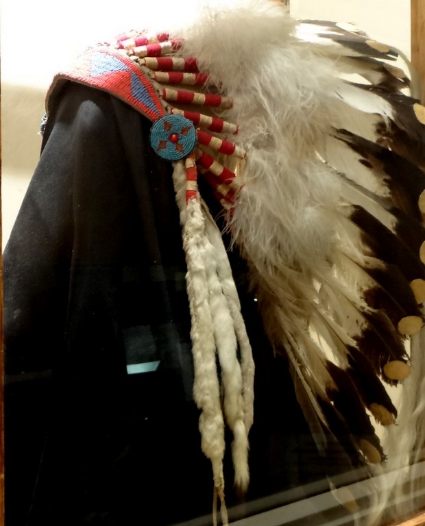
A buffalo stomach filled half full of water was used to boil meat and vegetables with heated rocks. Then, the stomach and all was eaten. The Blackfeet used every bit of the buffalo and survived for centuries. After the buffalo were slaughtered, they began to use and depend on trade goods from the white settlers and the old ways were slowly relinquished.
DSC00273 (Copy)
The Blackfeet didn't have chairs, but they made back rests of great beauty. They could sit on the ground and lean against the back rest for comfort and some protection from the cold plains winds.
DSC00288 (Copy)
The museum was well organized for ease of access to its collections. This old radio has the speaker mounted on top.
DSC00289 (Copy)
Maybe the first clock radio.
DSC00334 (Copy)
An item I'd never seen before, or if I had,  I didn't know this iron was powered by gas and not steam.
DSC00299 (Copy)
Nor was I familiar with John Clarke's paintings. A Blackfoot who became deaf and mute after suffering from scarlet fever as a child. He learned to paint his people. The curator told us he even has a piece in the White House.
On the curator's recommendation, I went to Naturally Curly for a haircut before we settled in the lot next to the city park for the night. It was delightfully breezy and quiet.

Monday, May 30, 2011

BEARDS HOLLOW AT SEAVIEW WASHINGTON


Overlooking Beards Hollow, a place where William Clark explored  very close to where we are parked. This area must have impressed him as it does me. It’s a northern rain forest. We hiked down to the landing and took pictures up and back.

Spring is evident, though its been cold and wet, even for this area.

Cottonwood seeding, blowing about, covering sections of water like snow flakes.

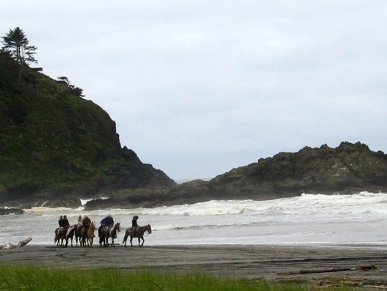
People here enjoy riding horses and cars on the beach. They are wide, long and easily assessable.

The surf is tinged with a dirty brown from an oil spill. But the air was clean and invigorating.

Rock here is definitely a souvenir of  old volcanic activity.

Harp rock, was named for its shape. Easy to climb about and explore. Lewis and Clark named obvious rocks so they could have reference points to give others and help their own navigation in new territory.

Volcanic Harp rock  plays host to numerous small plants,vines, and trees.

Ferns unfurling resemble plants from the age of dinosaurs.

Without my Western Garden  Book,  with some consultation on the walk with others, we decided this huge leaved plant is angels lace. A new leaf and blossom extrude from the same sheath at the same time.

I spotted this little snake trying to get some sun on a dead tree.

The area we hiked through is also a wetlands. At one time, it was covered by ocean. In this pond full of giant water lilies, a lightweight  bird, didn’t even dent its floating perch.
This plant reminded me of edible greens. We returned home for lunch, refreshed and hungry.

We visited this beach in 2008 without the awful residue of oil. Hopefully we can return someday to find it clean again.
I took 37 pictures if you’d like to see them visit my link:https://picasaweb.google.com/106530979158681190260/2011530BeardSPt#

Monday, May 17, 2010

HARPERS FERRY A MONUMENTAL STAGE OF HISTORICAL IMPORTANCE

John Brown organized blacks to take arms in hand and force the powers that be to end the owning of slaves. He aimed to take over the armory located at Harpers Ferry and use those arms for his revolt. He failed, and after a 36 hour siege in a small Firehouse, his heartfelt blow for freedom was over. They shot three of his raiders and captured them all. Brown was hung first after a trial in nearby Charles Town. He sat on his coffin on his way to the gallows. Three more raiders were tried and hung after him. His raid was downed by the local militia and Federal Troops under Robert E. Lee.
Afterward, the famous Firehouse was vandalized by souvenir seekers; it was dismantled, rebuilt, and over time,  moved to  four different sites before being returned to Harpers Ferry by the National Park Service, within 150 feet of its original location.While Brown went to his death thinking he failed, it was the eve of the Civil War, the swirling change of ideas about the owning of slaves fed his revolution and struck fear in slave owners that  this bold move may signify the first of more to come.  His actions further divided the nation over the issue of slavery and his actions helped launch the Civil War.


We walked the riverside that gave Harpers Ferry its strategic importance in History. Supplies were moved by water and the Shenandoah River meets the Potomic here, crashing together on their way to the ocean.
President Washington surveyed this area as a young man and chose it as a site for a Federal Armory to protect the area from insurgents. Thomas Jefferson extolled the virtues of this wonderful town. Black Freedman worked and thrived here along with whites with slaves.   

This bucolic town, now a National Park, once housed 3,000 people, all gainfully employed at a rifle factory, grist mill, cotton mill, taverns, a foundry, tannery, and all the small service industries, clothing, tobacco, butchers, candle and soap makers, schools and teachers, bakeries and hardware, plus the Federal Armory located here. By all accounts a successful and thriving city.
 This beautiful Church has a commanding view of town.
 
Hilly country side made land precious and the houses were tightly jammed together. But this touristy view was once a place where manure littered the streets, hogs ran free, outdoor toilets accompanied every building, working men spit tobacco in the streets and the butchers blood drained freely down the hillside into the river, attracting flies and vermin. A cholera epidemic killed 147 people one year.


White Hall Tavern didn't hold many customers, but it was a place for social gatherings essential to colonial life.

This  three story boarding house had amazingly roomy bedrooms. Soldierly types had to hang their canteens and arms in the foyer. The Appalachian Trail also runs through Harpers Ferry, and again we set foot on it out of curiosity. It actually goes over this Potomic Bridge at one point.

What an amazing place.
Lewis and Clark outfitted here. The rifles he took from this renowned factory may have meant the difference between success and failure. He invented a boat and tried it here, but it failed. A small museum tells the story.
Appreciating this strategic place, its position, the railroads and canals that pushed goods all the way into Ohio, and the issue of slavery on the dividing line of slave and free states is complex. The whole area, to do it well, takes two or three days and well worth the time. We spent one day. Every building is basically a museum. Two African American Museums, a John Brown museum and many interpretive exhibits and places to visit make this a must see if you are in the area. Its great to refurbish your sense of history and remember , John Brown, Frederick Douglass, Dred Scott, J.E.B. Stuart, George Armstrong Custer, W.E.B. Du Bois, Stonewall Jackson among the notables that played their part in this small town.
For an album of more pictures click the link below:

http://picasaweb.google.com/1579penn/51610HarpersFerryWVA#

Monday, June 15, 2009

ASTORIA JEWELS AND GOOD BEER


Fort Astoria marks the spot where the town of Astoria was begun. John Jacob Astor sent the schooner, Tonquin to seize the mouth of the Columbia and forever control the river and its traffic and the area Lewis and Clark explored. The first building was built in 1811. Palisades against the indians were added later. Not all of Astor’s plans succeeded, but the fort served as the business center for everyone who followed, adventurers, trappers, farmers, ship builders and entrepreneurs. The first white woman in the Northwest Territory, barmaid Jane Barnes, lived at this fort in 1814. The fort was sold to the North West Company to avoid capture during the War of 1812.

The 125 foot Astoria Column stands on top of Coxcomb hill. It is wrapped with sgraffito drawings, an Italian process where the paint colors are mixed with the cement, making them weather resistant and relatively permanent. The panoply of drawings depict significant events of the area and remind us of the significance of the great river Columbia where it meets the Pacific. The view over the valley from the grounds is spectacular. If you choose to walk up the 164 step spiral staircase to the top of the tower, it is even better. The tower is undergoing restoration-thus the crane.

Astoria Tower

Many old buildings remain in the heart of downtown Astoria. Don't miss the Liberty Theater. Completely restored in the opulent style of old theaters, the inside is exotically decorated with scenes from Venice, transporting you to a Venetian Palace with elegant light fixtures and heavy draperies. It operates now as a performing arts center.

We lunched at the Wet Dog Cafe where the food was expensive but the beers had no peer. Kick Ass Stout was my choice but tasters allow you to try Bitter Bitch Ale, Poop Deck Porter, DaBomb Blonde, Kirby Kolsch, Red Beard Amber, Solar Dog IPA, and Stone Cold Strong. Hmmm! A beer lovers heaven with a view to the ocean as well.

IMG_3129d

IMG_3128d

Tuesday, June 9, 2009

FORT CLATSOP, LEWIS AND CLARK


-Weather cooperated yesterday, the sun shone bright as we walked in the very footsteps of Lewis and Clark, from their landing on the riverbank to the place they built their fort. They named it to honor the friendly Clatsop Indians.
The Fort Clatsop Visitors Center reminds us that buying the Louisiana Purchase doubled the size of our country and forever changed the course of the world. Pretty heady stuff.
I'd forgotten so many details of the Lewis and Clark expeditions wonderful saga; the talent of the two men who literally measured their way across those thousands of miles of wild and exciting country. Half of the plant specimens they gathered and named still exist. They met hostile and friendly Indians but managed to communicate and befriend them. Not a shot was fired in anger. That, in itself, was an amazing accomplishment.
The two men served as biologists, scientists, hunters,doctors, explorers, builders, soldiers, navigators and leaders of men. I promised myself to reread the book that includes their journals of this marvelous journey.
Fort Clatsop was restored in the 1980's only to burn down and get rebuilt in 2007/08. The picture shows the newness of the wood sitting in an old growth forest.

From the Indians, they learned what plants were edible and medicinal. They learned to build dugouts from river tribes along the way. Dugouts weren't dependable ocean going vessels The Clatsop and Chinook used wider, lighter, high prow cedar canoes in the rough waters where river met ocean.
The party chose the Oregon side of the Columbia river to build their fort after being trapped by an horrific storm on rocky cliffs for six days on the opposite side of the river. That spot is named Dismal Niche. There are many hiking trails and sights to see at this wonderful National Park.
Nothing was named for Sacagawea, their indispensable guide, but, it was the way of things then, to disregard the accomplishments of women. Without her, they may not have survived the trip.

Sunday, June 7, 2009

TSUNAMI WARNINGS, SEASIDE, LEWIS AND CLARK


(The first photo shows the Lewis and Clark company salt burner)

Touristy beach towns have satisfying similarities, in some ways. Besides the smell of the seaweed, and salt ocean, walking the short streets brought layers of odors. Salt water taffy, mingled with caramel corn. Then a hint of hot sweet coffee and the powerful odor of burgers and french fries. At one point it was batter fried fish of some sort next to burned cotton candy and maple syrup. A waft of chocolate and peanuts. An ice cream store on every street corner. Yum!
Thai, Greek, Italian, Mexican food...the smells were tumbling out of the store fronts between windows of gifts featuring kitschy souvenirs, quality paintings, glass works, incredibly talented hand crafts, jewelry and the inevitable T-Shirt, baggy shorts, and flip flop boutiques. Throw in a skate board, boogie board, tattoo and swim wear shop and you have it all. Summer heaven for kids. Not many have tsunami warnings.
Weather was coolish, and the tourists aren't yet swarming, but, those that were about town were enjoying it as much as I enjoyed people watching.

We stopped to see the End of the Trail. This beach is the western terminus of the Lewis and Clark expedition. They spent time making salt and their salt burner still stands preserved. A statue marks the site. Brass medallions decorated a bridge over an un-named river pouring into the ocean, commemorated their feats, as well.
The town itself has those quaint salt box houses dripping with giant blooming rhododendrons everywhere. one had lobster shutters. Another we saw had buoys hanging from the garage eaves. Its a fun place to visit cold or hot.

Not every beach town has a carousel. They are becoming scarce, but, here sits a beauty with wonderfully imaginative animals to ride. Around town, inside a building, no less, was bumper cars, a tilt-a-whirl and kiddie rides plus several arcades with flash-ball and other wonderfully absorbing games designed to separate every healthy teenager from his change.
A 1/2 dozen places rented bicycles, and quadcycles built for four. Some bicycles built for two, adjacent style, hold baskets for a couple of kids. A smiley faced electric vehicle screams RENT ME!!


For more pictures of Seaside and Lewis and Clark stuff, click on the web link below for a quick slideshow.

http://picasaweb.google.com/1579penn/SeasideOR#