Showing posts with label drought. Show all posts

Tuesday, January 3, 2017

NEW YEAR'S DAY HIKE.

img_0450-copy
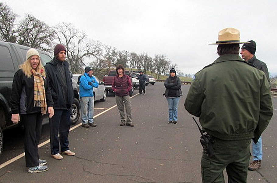
From Highway 49, Glory Hole Recreation District at New Mellones, a free hike was advertised for New Years Day, rain or shine. You can see people warmly dressed as we strangers met at the entrance station and introduced ourselves.
img_0451-copy
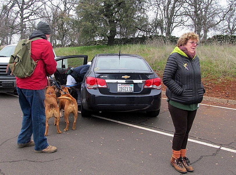
Dogs are allowed on the trails. We met two bikers and we saw evidence of horses using the trails. Walkers are asked to give way to horses, but we didn't meet any.
img_0452-copy
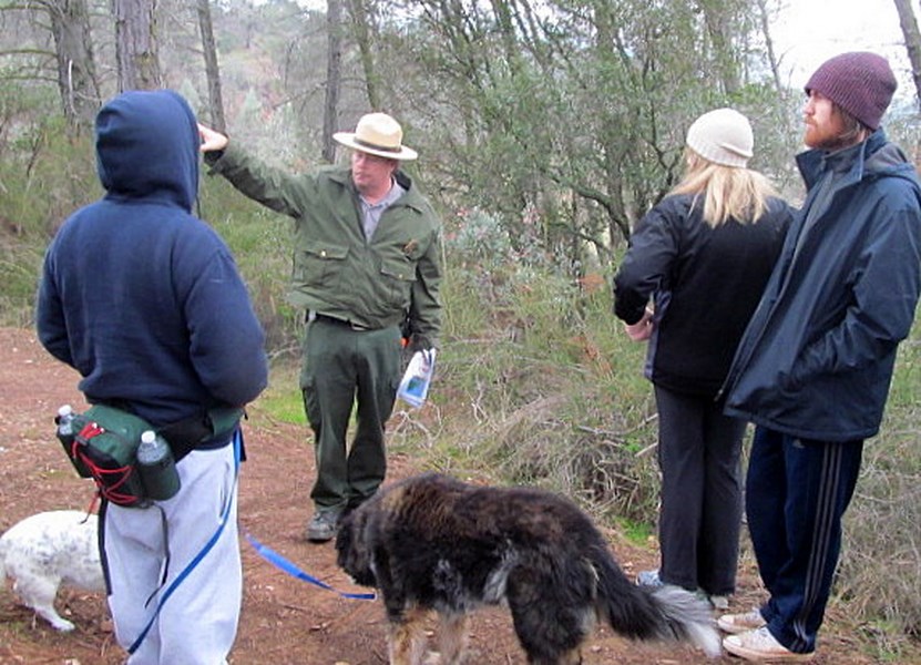
Ranger Josh, guided the group and pointed out the growth patterns of this type of forest and explained in some detail the various flora and fauna.img_0455-copy
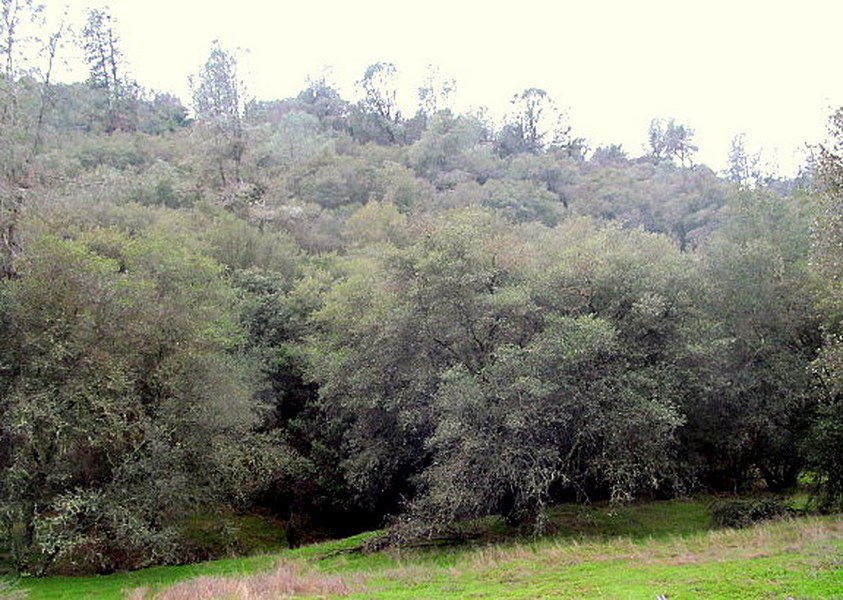
At the beginning of the Angels Creek Trail, the forest has a mixture of digger pines, black oak, live oak and thick underbrush.  Ranger Josh admitted the underbrush is a fire hazard with chemise and buck brush.
img_0457-copy
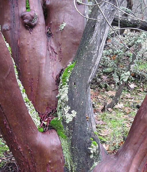
I was impressed by the girth of this giant manzanita specimen and the lichens and bright, green moss growing on it. Ranger Josh noted that the east side of the hills get most of the water. He told us that manzanita burns very hot and can burn up your stove, actually melt it if you use enough of it.
img_0463-copy
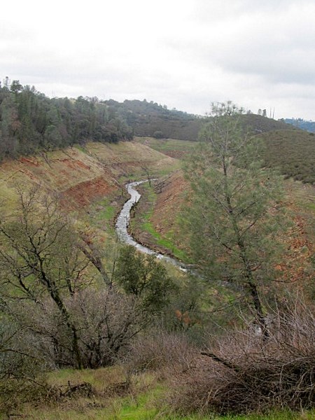
Angels Creek is low, in tune with the current drought situation. The trail is a 2.5 mile hike.
img_0472-copy
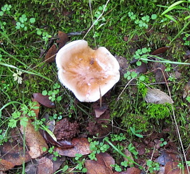
I looked at just about every mushroom, hoping to find a "buckskin". (Not it's scientific name.) The old Italians knew their mushrooms and would pick up large delicious mushrooms under manzanita habitat. I didn't find a one. Deer feed on these, as do various insects.
img_0453-copy
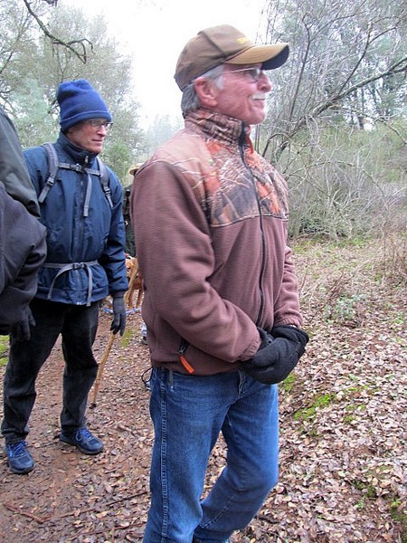
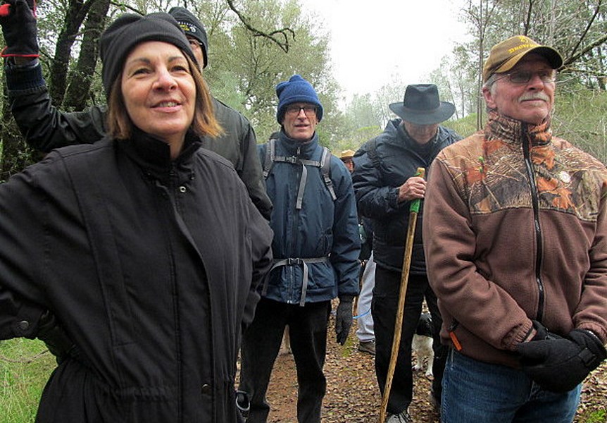
I didn't get many pictures of the hikers. Strung out in a line, it is hard to capture everyone. The trail is narrow in most places. Looking back and forth I believe we had about 30 people on the hike. The Calaveras side of the Recreation Area has seven trails of different lengths and are rated easy, moderate, challenging and so on. This trail is moderate.
img_0454-copy
When guided, Ranger Josh makes many stops and he even played a couple games with us. He formed us into a walking caterpillar, eyes closed, to just walk and tune your ears, nose and senses to the trail. If you are a lone hiker, you get the sense of quiet that being in a natural forest gives you.
img_0466-copy
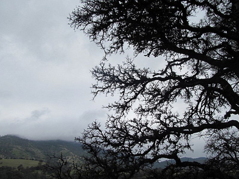
The sun didn't come out during our 3 hour hike. This tree, etched against the overcast made a nice contrast, with the west side of the hill in the distance showing meadows; more barren than the brushy east hillside.
img_0471-copy
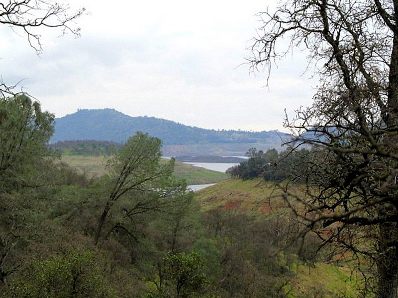
At the end of the trail was a pretty view of the lake with an island showing that isn't visible when the water level is normal. Drought conditions persist here in California though the recent rains are encouraging. The Calaveras side has seven trails and the  Tuolumne County, Tuttletown Recreation area also has seven trails.  Senior Citizens, with their pass can enter the hiking trails free at anytime of year. For most, there is a day use charge.

This was my first excursion with a new social singles group  and I got to meet the seven people at the end of the hike. Cindy is the key organizer and can be reached at this phone number if you are interested in joining. I didn't ask permission to print her phone number, (no addresses are given), but her number was published in the newspaper ad for this hike, so here goes. 209-559-8517. The only qualification, you must be 50 or older. We picked up two new members at this event.

Monday, February 9, 2015

MYSTERY SOLVED AND WATER NEWS.

February 9, 2015

The rains have been welcoming if disconcerting with multiple lightning strikes, gloom, and water cascading down my driveway. The news is, despite this pleasant drink of water, the drought will continue. oroville
The reservoirs are no longer holding enough water. I have a well and expect to get it up and running to bastion my property against the drought. It hasn’t been operated in over ten years. The aquifer may be empty and not suitable.  Time will tell.
New tires will be rolling me to Oregon at the end of this week for some needed input into the house building job. The tires will be installed this morning.
FLASH- The Mystery Santa was neighbor Peggy Morris. I called once with no answer but finally spoke to her last night. What a delightful thing to receive this lovely Christmas letter in my EMAIL box. Too fun!
DSC06273 (Copy)
Peggy denied being the mystery Santa of the second letter. Hmm!  I’m narrowing down the suspects.
Ciao


Thursday, October 23, 2014

TOMORROW, TOMORROW, THERE'S ALWAYS TOMORROW.

This morning, I bring Karen to the hospital for her surgery early in the morning. Then take Jim to his post-op appointment at Palo Alto Veterans Hospital. Karen's friend Tom will pick her up and bring her home. 
Jim and I return tomorrow. I've been diligently watering and packing stuff off to my storage unit. Fall is definitely here with nights getting down to 43 and 44 degrees. But, no rain in the forecast.
I have a new internet service called Uverse. It is supposed to be much faster than DSL. I don't think it is super fast, but the data you can transfer is huge and  it does play video's which my old system often could or would not.
It seems all we do is TALK about the weather and wish it were better. I got this Weather Trivia in an email from Ron Heinsma and I don't know its origin. Hope you find it amusing.
Weather Trivia.


10 cities with
Least weather variety

Based on temperature variation, precipitation, wind, severe weather
  1. San Francisco, California
  2. San Diego, California
  3. Los Angeles, California
  4. Santa Barbara, California
  5. Eureka, California
  6. Long Beach, California
  7. Honolulu, Hawaii
  8. Santa Maria, California
  9. San Luis Obispo, California
  10. Kahului, Hawaii


Top 10 hail prone cities
Based on frequency and severity of hail
  1. Tulsa, Oklahoma
  2. Amarillo, Texas
  3. Oklahoma City, Oklahoma
  4. Wichita, Kansas
  5. Dallas/Fort Worth, Texas
  6. Arlington, Texas
  7. Denver, Colorado
  8. Colorado Springs, Colorado
  9. Shreveport, Louisiana
  10. Kansas City, Missouri/Kansas


Top 10 Tropical storm / Hurricane prone cities
Average # of years with no storm. Totals based on data from 1871- 2007, hitting within 60 miles of the city
  1. Cape Hatteras, North Carolina
2.49
  1. Delray Beach, Florida
2.54
  1. Hollywood, Florida
2.58
  1. Deerfield Beach, Florida
2.58
  1. Boca Raton, Florida
2.58
  1. Florida City, Florida
2.63
  1. Grand Isle, Louisiana
2.63
  1. Ft. Pierce, Florida
2.69
  1. Miami, Florida
2.69
  1. Ft. Lauderdale, Florida
2.69
Top 10 Tornado states
Avg number of tornadoes per 10,000 square
Miles, occurring from 1953-2004
  1. Florida
9.4
  1. Oklahoma
8.2
  1. Kansas
6.7
  1. Iowa
6.6
  1. Illinois
6.2
  1. Indiana
6.1
  1. Mississippi
5.7
  1. Maryland
5.7
  1. Louisiana
5.6
  1. Texas
5.2
Top 10 Thunderstorm
Cities

Avg annual number of thunderstorms
  1. Fort Myers, Florida
89
  1. Tampa, Florida
87
  1. Tallahassee, Florida
83
  1. Gainesville, Florida
81
  1. Orlando, Florida
80
  1. Mobile, Alabama
79
  1. W. Palm Beach, Florida
79
  1. Lake Charles, Louisiana
76
  1. Daytona Beach, Florida
75
  1. Vero Beach, Florida
75
Top 10 Tornado prone cities
Ranked by tornadoes per 1,000 miles
  1. Oklahoma City, Oklahoma
  2. Tulsa, Oklahoma
  3. Dallas - Ft. Worth, Texas
  4. Wichita, Kansas
  5. Springfield, Missouri
  6. Kansas City, Kansas/Missouri
  7. Ft. Smith, Arkansas
  8. Little Rock, Arkansas
  9. Jackson, Mississippi
  10. Birmingham, Alabama


Top 10 Earthquake prone states
# of earthquakes in the last 30 years
Centered in the state
  1. Alaska
  2. California
  3. Hawaii
  4. Nevada
  5. Washington
  6. Idaho
  7. Wyoming
  8. Montana
  9. Utah
  10. Oregon


10 all-time hottest
Temperatures

Obtained from state temperature
Records, NCDC
  1. Death Valley, California
134
  1. Lake Havasu, Arizona
128
  1. Laughlin, Nevada
125
  1. Lakewood, New Mexico
122
  1. Alton, Kansas
121
  1. Steele, North Dakota
121
  1. Ozark, Arkansas
120
  1. Tipton, Oklahoma
120
  1. Seymour, Texas
120
  1. Usta, South Dakota
120
10 all-time coldest
Temperatures

Obtained from state temperature
Records, NCDC
  1. Prospect Creek, Alaska
-80
  1. Rogers Pass, Montana
-70
  1. Peters Sink, Utah
-69
  1. Riverside, Wyoming
-66
  1. Maybell, Colorado
-61
  1. Tower, Minnesota
-60
  1. Parshall, North Dakota
-60
  1. Island Park Dam, Idaho
-60
  1. McIntosh, South Dakota
-58
  1. Couderay, Wisconsin
-55
10 hottest cities
Average annual temperature, F
  1. Key West, Florida
77.7
  1. Miami, Florida
75.6
  1. W Palm Beach, Florida
74.6
  1. Ft. Myers, Florida
73.9
  1. Yuma, Florida
73.9
  1. Brownsville, Texas
73.6
  1. Orlando, Florida
72.4
  1. Vero Beach, Florida
72.4
  1. Corpus Christi, Texas
72.1
  1. Tampa, Florida
72.0
10 coldest cities
Average annual temperature, F
  1. International Falls, Minnesota
36.4
  1. Duluth, Minnesota
38.2
  1. Caribou, Maine
38.9
  1. Marquette, Michigan
39.2
  1. Sault Ste Marie, Michigan
39.7
  1. Fargo, North Dakota
40.5
  1. Williston, North Dakota
40.8
  1. Alamosa, Colorado
41.2
  1. Bismarck, North Dakota
41.3
  1. St. Cloud, Minnesota
41.4
10 driest cities
Avg annual precipitation in inches
  1. Yuma, Arizona
2.65
  1. Las Vegas, Nevada
4.19
  1. Bishop, California
5.61
  1. Bakersfield, California
5.72
  1. Phoenix, Arizona
7.11
  1. Alamosa, Colorado
7.13
  1. Reno, California
7.49
  1. Winslow, Arizona
7.64
  1. El Paso, Texas
7.82
  1. Winnemucca, Nevada
7.82
10 wettest cities
Avg annual precipitation in inches
  1. Hilo, Hawaii
128.00
  1. Quillayute, Washington
104.50
  1. Astoria, Oregon
69.60
  1. Blue Canyon, California
67.87
  1. Mobile, Alabama
64.64
  1. Tallahassee, Florida
64.59
  1. Pensacola, Florida
61.16
  1. New Orleans, Louisiana
59.74
  1. W Palm Beach, Florida
59.72
  1. Miami, Florida
59.55
10 snowiest cities
Avg annual precipitation in inches
  1. Blue Canyon, California
240.8
  1. Marquette, Michigan
128.6
  1. Sault Ste Marie, Michigan
116.7
  1. Syracuse, New York
111.6
  1. Caribou, Maine
110.4
  1. Mount Shasta, California
104.9
  1. Lander, Wyoming
102.5
  1. Flagstaff, Arizona
99.9
  1. Sexton Summit, Oregon
97.8
  1. Muskegon, Michigan
97.0
10 windiest cities
Avg annual wind speed in mph
  1. Blue Hill Observatory, Massachusetts
15.4
  1. Dodge City, Kansas
14.0
  1. Amarillo, Texas
13.5
  1. Rochester, Minnesota
13.1
  1. Casper, Wyoming
12.9
  1. Cheyenne, Wyoming
12.9
  1. Great Falls, Montana
12.7
  1. Goodland, Kansas
12.6
  1. Boston, Massachusetts
12.5
  1. Lubbock, Texas
12.4
10 sunniest cities
Annual percent of possible sunshine
  1. Yuma, Arizona
90%
  1. Las Vegas, Nevada
85%
  1. Phoenix, Arizona
85%
  1. Tucson, Arizona
85%
  1. El Paso, Texas
83%
  1. Flagstaff, Arizona
79%
  1. Fresno, California
79%
  1. Reno, Nevada
79%
  1. Sacramento, California
78%
by Earl Tupper.NEW JERSEY .................. Has the most shopping malls in one area
in the world.NEW MEXICO ............... Smokey the Bear was rescued from a 1950
forest fire here.
NEW YORK .................... Is home to the nation's oldest cattle
ranch, started in 1747 in Montauk.
NORTH CAROLINA ........ Home of the first Krispy Kreme doughnut.
NORTH DAKOTA ............ Rigby , North Dakota , is the exact
geographic center of North America ..
OHIO ............................. The hot dog was invented here in
1900.
OKLAHOMA ................... The grounds of the state capital are
covered by operating oil wells.
OREGON ......................... Has the most ghost towns in the
country.
PENNSYLVANIA ............. The smiley : ) was first used in 1980
by computer scientists at Carnegie Mellon University ..
RHODE ISLAND ............. The nation's oldest bar, the White Horse
Tavern, opened here in 1673.
SOUTH CAROLINA ......... Sumter County is home to the world's
largest gingko farm.
SOUTH DAKOTA ............. Is the only state that's never had an
earthquake.
TENNESSEE ....................... Nashville 's Grand Ole Opry is the
longest running live radio show in the world.
TEXAS ............................... Dr. Pepper was invented in Waco
in 1885. The hamburger was invented in Arlington in 1906.
UTAH ................................. The first Kentucky Fried
Chicken restaurant opened here in 1952.
VERMONT ........................ Montpelier is the only state capital
without a McDonald's.
VIRGINIA ........................... Home of the world's largest
office building, The Pentagon.
WASHINGTON .................. Seattle has twice as many college
graduates as any other state.
WASHINGTON D.C. ......... Is the first planned capital in the world.
WEST VIRGINIA .................. Had the world's first brick paved
street, Summers Street, laid in Charleston in 1870.
WISCONSIN ...................... The ice cream sundae was invented here
in 1881 to get around Blue Laws prohibiting ice cream from
being sold on Sundays.
WYOMING ........................ Was the first state to allow women to
vote.
I hope you enjoyed this. I found it interesting!!!
 

Thursday, June 26, 2014

WHAT DROUGHT LOOKS LIKE, PLUS, INSURANCE, CONFUCIUS

DSC06976 (Copy)

Yesterday, I had to drive my Prius back across the river for the body and fender guy to take pictures of the inside of my vehicle so the insurance company could make their decision on whether to total it, or fix it.  This time I remembered my camera. Click the picture to enlarge it and you will be able to see the line of the old road down into the canyon before the dam was built.
DSC06979 (Copy)

Here is  closer shot. Tree tops are showing that once grew on the river’s bank.
DSC06980 (Copy)

A closer shot. I used to love to drive this road and was on the side of the protesters trying to keep the river scenic and wild.  A guy named Mark, forgot his last name, tied himself to a rock so that if it flooded he’d drown. His ploy didn’t work, obviously. The protests raged on for months and got desperate toward the end.
DSC06981 (Copy)

Of course it is all water under the bridge, to quote a cliché. By the way, I had two people ask me why I had to drive the 18 miles to the body shop instead of an insurance adjuster coming out to make the decision. The body shop guy told me, “Oh, we do that. We take the pictures and they make the decision from there. It saves you money” Huh!  Do I believe it saves ME money?  Not for a minute. The woman who hit me paid big premiums for her full coverage, $100 deductible, she told me. Another short cut, downsize jobs. Ugly. I’m very disenchanted with our corporatocracy. We need  some balancing socialized government, like medicare and no child left behind. Similar programs that protect people. Isn’t government supposed to be …by the people, for the people?   It reminded me of a great quote from a man who lived before Christ was born. Ever wise Confucius  said:

When a country is well governed, poverty and a mean condition are things to be ashamed of. When a country is ill governed, riches and honor are things to be ashamed of.

Unfortunately, we do not learn from mistakes of the past.

Monday, June 11, 2012

CLIFF PALACE AT MESA VERDE

Aptly named Cliff Palace, this cliff dwelling is the largest in the United States and is the one most often seen in magazines and tourist brochures about ancient ruins.
It is the only major cliff dwelling in the park that can be seen from an overlook.  I was disappointed in my pictures of the Weatherhill Long House, but here you can see the dwellings from a distance and get an  idea of what the whole settlement looks like in two photos.
The tour starts on the left and moves off to the right.

A tighter shot also taken from the overlook. Notice the tower in this photo and a comparison of what the site looked like when it was first photographed by a  Swedish Scholar, Gustaf Nordenskiold, in 1891. He was the first to scientifically study the site though it was officially “discovered” by Weatherhill,  local ranchers and curiosity seekers knew of its existence.

Quite a difference. Much debris from many years of neglect, but hey, the 1100′s was a long time ago. From the overlook,  our group proceeded down into the canyon.

Jim is moving a bit slowly. He was in pain this morning from overdoing a things a bit yesterday, despite the meds.

Then up this small ladder and you are at the beginning of the tour.

Because the ancient Anasazi (the preferred word is now Puebloans)  seemed to have abruptly vanished, Bill Slaughter, our guide,  posed  some  questions to think about as we viewed the site:   Who are the ancient Puebloans?  Where did they go? What made them leave?

There is much scientific study about the ancient Puebloans.  They speculate that because there are so many kivas at this site, those who decided to leave their nomadic way of life as hunters and gatherers and build cliff dwellings, supported a greater community of Puebloans in the surrounding Mesa Verde area. I believe he said the palace has 11 kivas.  From local Native Americans who still use kivas for political and ritual uses, scientists speculate that the same was true of the ancients.

Other kivas we’ve seen could only be entered by a ladder through the roof. This advance in building skills allows the person to walk into the kiva through a “keyhole” entrance.

A three-story “apartment” house, and other buildings on site are so straight, scientists speculate they may have used a plumb bob to align their  buildings.  Small rocks with a hole drilled through them were found on site that could have served that purpose.

A crevice above the dwellings was used to store corn and beans to keep it from rodents and birds and weather.

The Puebloans built round as well as square buildings with great skill. Sandstone is a good, long-lasting building material when not subject to harsh storms. They could hand chisel rocks to fit. It had to be  a major decision to give up their nomadic lifestyle and hunker into the cliff sides and build such protected houses. Most likely, for some protection from conflicts. There were probably 30 to 50 thousand Puebloans in the area.  And while there is no sign of conflicts in the cliff dwellings,  conflicts arouse over a diminishing source of food and game and other resources like wood in the greater area below the mesa in what is now Cortez and surrounding areas.

Examinations of bodies show a people somewhat protein deficient.  All of the big animal bones were gone from the upper layers of the middens, no deer, elk or sheep bones. The Puebloans were living on small game, like rabbits and turkeys.

The cliff location provided protection and water. They dry farmed and depended on winter snow melt and summer rains to grow their corn. A 23 year drought may have driven them to take up their nomadic lifestyle once again.  They didn’t just disappear,they moved.

There is plenty of evidence linking the ancients to the local Ute and Hopi tribes.  This is their ancestral lands. Even some DNA evidence.

The climb out of the canyon is steep and about 180 feet up.

I thoroughly enjoyed the rock climbing aspects of squeezing through tight spots and between gigantic boulders, but Jim was getting a workout he didn’t need at that point.
We, at least, had steps and handrails. The ancients made it up the cliffs barefoot. Their hand and toe holds could be seen carved into the rock at this spot.

.

The final three ladders are bolted into the cliff.  If you go, the rangers give you excellent information about how strenuous each tour is. I didn’t find this a strenuous trip, despite the altitude of 7,500 feet. It is possible to do two tours, or even the three major dwellings in one day. The most challenging is Balcony House.  Since Jim was in no shape to attempt a second tour we skipped it, but I told him he’d have to drag me back here to take it another year.

There is much more to do here if you can hike two to five miles.  And there are longer hikes to see hidden dwellings and petroglyphs described by yesterday’s, guide, Pam Slaughter, as “very beautiful.”  The museum is excellent. Don’t miss the 25 minute film.  We drove the loop and looked at views of lesser dwellings on the way back to camp.  Then we enjoyed watching the deer eat while we enjoyed our own supper.
I always take way to many photos, but if you’d like to see my album, click on the link:
https://picasaweb.google.com/106530979158681190260/2012610MsaVrdeClifPalace?authkey=Gv1sRgCK7e2-XDmLeBKA#

Saturday, February 7, 2009

PARROTS FERRY, NEW MELLONES, DROUGHT AND THE WEATHER

Some of us love weather. There is just something about the bluster and change that winter brings; the winds of March and the bursting greens of spring with hot summers to follow that makes you feel alive. But...not so for Jim. He likes the 74-80 degree weather pattern and if HE were to control, it wouldn't change. He is driving to Murphys in his motor home as I write and I haven't warned him that the weather report is predicting snow-OH, NO, SNOW-down to 2,000 feet. He hasn't been rained on in 8 years, or some such! Haven't a clue what will happen if the white stuff actually touches his skin. Yikes!
But, you know, the drought is upon us and we need that water even if it comes down as bits of ice. I took a picture of the Parrots Ferry Bridge over New Mellones. The red dirt shows how low the reservoir is and how dismal the future for Calaveras County and California in general, if this dry trend continues.
Soooo, I've got wood for the fire, I'll mull some wine, light the candles, and cook up some South of the Border Stew. Ahh. Stave off the chill. But, I think I'll hide the thermometer just the same.