Sunday, February 28, 2010

SUN AND MOON


One benefit of being a road gypsy, we manage to see sunrise and sunset almost every day even during the summer. We took a moonlight walk last night and concluded that photographing the moon is tough. You need a tripod and a time lapse option on your camera. Sunsets are pretty easy. The one above was taken in Monroe, WA. The one below, too, along the Skykomish River.


The Yuma Crossing Bridge. We road ten miles on our bikes to get this photo.


This one was at Cypress Cove last week, Venice Louisiana. Winter sunsets are rarer with a lot of color.

Yesterday was chore day. The Bronco still has remnants of some awful grit we picked up in Venice, even after a car wash. The Motor Home is waiting. We found the Health food store closed-for good. Louisianan's enjoy deep fried shrimp and oyster Poboys. They seem less concerned about diet than where I live. People seem happier here, too. Could there be a connection?

Saturday, February 27, 2010

SURPRISES ON THE ROAD TO HOUMA

We left Golden Meadow and headed for the “big” city of Houma. Via the internet, we found J. & N. truck stop, a place to water, gas up, dump your tanks and wash the vehicles. Jim chose the scenic route, a narrow road that follows a marsh and ends in the very small town of Du Lac where we wanted to try much touted seafood dishes at Schmoopy’s Restaurant.

Our first surprise was running into an insurance check point on a stretch of road that gives you no place to turn around. What a novel idea. We chuckled some, and decided it was a dang good idea. With 15 years on the road, Jim had never seen an insurance check point.

Our second surprise was this gorgeous pristine marsh. Jim likes little used back roads. Thirty miles of twisting curves and little traffic allowed us to enjoy the marsh plants and birds free of any human intervention, it seemed. We saw no garbage, plastic bags, old bottles and tires anywhere, the marsh as nature intended it to be.

What a treat. The pictures don’t do it justice because sitting high in the motor home gives us a better view than standing on the ground.

We pulled into the small town of Du Lac and headed for Schmoopys, a restaurant touted for its good fresh seafood. The haphazard gravel and dirt parking lot was full without any obvious place to accommodate a motor home and “toad.” Some guy said, “You could park it out back if that red pick-up wasn’t in the way.” The pick-up in back of Schmoopys was taking up a lot of room but slowly and carefully Jim managed to squeeze by. When we got upstairs, (this restaurant is on stilts) this guy came out of the kitchen with a big smile and welcomed us heartily. He told us he watched us from above. It was his pick-up. We learned later, he was the boss.

I rarely order anything deep fried but when sampling new cuisines, all rules are suspended. I made a complete meal out of appetizers, all of which were deep fried. Home made crab pups, filled with crab, creamed cheese and a bread stuffing; mini crawfish pies with a Louisiana roue made of celery, onion and green pepper and a flour & oil gravy; and bacon wrapped oysters battered and fried. Delectable, every one. Jim is fond of bisque and declared it delicious. His meat pie, also an appetizer, was much like a cornish pasty and tasty. People thought I was a bit strange, I guess, taking pictures of our food. For me, oysters are best raw, except for these, the best cooked oysters I’ve ever tasted. He had other menu items I’d never heard of. I wanted to try them all. If you get a chance, go to Schmoopys.

We traveled through several small towns and stopped to buy a greeting card at a Dollar General where we got another surprise. The clerk below tested my one dollar bills. Whaa? She told me she had accepted a counterfeit ONE DOLLAR BILL? I couldn’t help but chuckle and asked her if I could feel it and take pictures. She consented but didn’t think it was near as funny as I did. She complained that she had to “eat” it.

The back of the bill was much too bluish in color. It felt like real money linen, though.

The front looked very authentic. I guess copy machines and kids got away with a minor theft-my guess. But, a one dollar bill?

When we got to J&J, they no longer wash trucks and motor homes. It started to rain. Who knows, maybe tomorrow we won’t need a car wash.

Friday, February 26, 2010

WANDERING BAYOU LAFORCHE

Living in small towns has its benefits and its difficulties. Raceland had no laundromat nor liquor store. People here don’t drink much except beer. Jim is a good planner and got on the internet and found where the last crossing over the Bayou was located, the drawbridge above. The internet also disclosed a Washateria in Golden Meadow, but no liquor store to be found. It was a nice drive along the Bayou Lafourche.

Both sides of the Bayou were lined with fishing rigs like the shrimp boat above, fancier than the smaller boat below. They are equipped with all kinds of electronic equipment and mechanical devices. A shrimp doesn’t have a chance. You see nets in the smallest “ponds” of shallow water. One guy told me he didn’t care whether he ever ate another shrimp. He just can’t get excited about them anymore. My impression was they are like water cockroaches. Kind of makes you wish your back yard were so infested.

The boat below brings in oysters. Looks like he has lunch everyday on board.

We found our Washateria and got our haircuts at Karen Morales shop, the only one in town. She said for entertainment, people here go to Houma events and the Casino. One of her customers was waxing enthusiastic over a “salt shower”, something I’d never heard of. You lie on a bed of salt and a hot steaming spray melts the salt and apparently makes you feel wonderful. Karen lamented the fact her kids don’t speak French and she worries that the cajun language is disappearing. Even her French is lacking, she claimed. I remember Charles Kuralt, the television personality, listening to a Cajun man voice the same worry over thirty years ago, but Cajun is still going strong, and I”m grateful.

We parked along the Bayou for the night and saw this little boat with a long history.

How innovative that the owner installed a regular old well pump to bail water. The boat is in need of some tender loving care. I hope it gets it.

Jim uses the internet so often to plan where we go, you know if the place your headed is open or not, what roads to avoid, etc. It makes me wonder how people got along without it on the road?

Thursday, February 25, 2010

REST STOP

Jim and I left Venice and threaded our way back to civilization. Since Katrina, people who live and work in Venice and surrounds, have to drive one and one-half hours to do grocery shopping in Belle Chasse. There are no movies, restaurants, bowling allies, bingo games or Community Clubs in Venice. We asked Terri, the attendant at Cypress Cove why do people live here? Jobs, is the answer, and family. The oil rigs are located here and oil riggers are well paid. Everyone else loves fishing and charter operations. If you are married to one…well, you get a job to have something to do or you read and watch television. (No library, but you can order books on-line.)

On the trip back, I smiled at some business names, and signs, along the way.

Madre And Sons Towing. Sounds stronger than Mother and Sons.

Born To Fish Charters. Now that is the one I’d try if I were looking to go fishing.

Along the road, its common to see restaurants with warm and fuzzy names like Country Cooking, Home Cooking, Just like Moms, or Mom’s Kitchen, or something referring to good old Mom. How about Maw’s Place. Now, that’s “down home” for ya.

At one Katrina wrecked house we saw a home made sign that read: Ronnie Graniers Back. A little welcome note of triumph.

And, speaking of triumph, there is a town with that name, Triumph, LA.

In one of my previous lives, I collected stamps and postmarks. I meant to find towns all over America with interesting post marks, like Why, AZ or Cut N’ Shoot, TX, North Pole, AK, Panic, PA, Normal, IL, Peculiar, MO, Waltz, MI, and , Whynot, MS. It was fun at the time. Now post marks are machine made and centralized to larger towns. You have to write to the Post Master to get the mark of a small local place. Collecting post marks is a good way to get kids get interested in maps and geography. Adults, too.

It rained when we left Venice and the motor home and Bronco are spattered with mud. But, we are parked in Raceland, its gonna be a sunny day, and who knows what’s around the corner?

Wednesday, February 24, 2010

BE AT POULOSKIS AT 1700

Late yesterday, Jim got a mysterious text message on his phone, "Be at Pouloskis at 1700." He left a return text, "Where is Pouloskis? " We asked everyone we ran into if they knew where Pouloskis was? No one we talked to in Cypress Cove had a clue where or what Pouloskis was. Terri, the office attendant at Cypress Cove even looked up boat names that register into the area. Nothing. We were at a loss and hadn't found a ride. A visit to Pilot Town was looking pretty dim for Tuesday. Its the off season for fishing and many boaters have alternative season jobs.

We called several local marinas and got names. We called numbers plastered on the sides of boats passing by. Tuesday dawned cold, gray and windy. At 11:00 a.m. Chris Calloway called us and offered to take us to Pilot Town on an open boat. We debated briefly since neither of us brought winter clothing. "Bundle up, you are gonna be cold," he told us. When would we have another opportunity to visit this unusual place?


Chris knows how to dress for an open boat. He promised we wouldn't get wet. We managed to avoid frostbite on the 20 minute drive over. A slew of cliche's come to mind, like "colder than a well digger's ass in the Klondike."

When Chris pulled up into Pilot Town, a pilot boat was backing up to the dock. The skipper was a retired 25 year employee of Texaco, now working as an engineer on the pilot boats. Hewett Peles informed us what everyone else had already told us, and what we had read, "There is nothing here to see!"


Yeah, we know. We aren't normal tourists. We don't only flock to tourist sights. He told us the pilots used to work several branches of the river, they were called the Branch Pilots. "Now, the branches are all full of sand. They have dredges taking the stuff out, but they'll be at it forever. Only one branch near the gulf is navigable now," he told us. We asked which direction to the post office. "It was only a trailer on piers. It was one of the first buildings to go in Katrina," he said. The building below is floating on a barge and is in good shape.


The Pilot's barracks was in good shape. At first we thought the sign was a joke since this is a very quiet community, but people come here to hunt and guns are noisy.


This building right next to the barracks was clearly damaged during Katrina, but others were far worse. Below you see the piers for the boardwalk and house, all that is left of this residence.


Air conditioners, stoves, refrigerators and washing machines lay rusting about where they once graced peoples houses. We saw a door with the knob still on it floating in the water and the pink bathtub below overgrown with weeds.


We walked the cement "boardwalk" , built in 1993, in both directions as far as it would go. We saw about 5 intact buildings and many crushed beyond repair, sunken into the swamp or gone altogether.


Chris then took us around the North side of the Island to see the camps which suffered little damage. Small cabins on stilts. He had never visited or navigated around Pilot Town and he showed us the depth gauge reading 23 1/2 feet change within 100 yards to 2 feet. Nature reasserting itself, trying to rebuild the island in its own way. We saw egrets that looked like flamingos because they had eaten enough shrimp to turn temporarily pink; raccoons, ibis', and many other birds. It is/was a unique community in that all houses there are built on stilts or float.

It wasn't our intention to go to Pilot Town to document Katrina damage, but to wander as far south in Louisiana as we could go, just for the heck of it. We did it! We decided to celebrate our adventure.


When we returned home, Jim claimed his fingers were still cold enough to chill the champagne. (Whatta ham!) As for Pouloskis? He never returned our message. There is a military installment nearby, military time-1700? We decided it was just a wrong number.

Tuesday, February 23, 2010

VENICE, PILOT TOWN

http://neworleanspodcasting.com/JimJailletandMaryMatzek.shtml

Yesterday, Jim and I heard from Craig Kraemer, the guy who interviewed us for his podcast. If you are interested you can click the link above and hear our interview. You press the "plug" to get it to play.

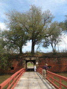
Several months ago we watched a video of Charles Kuralt, a long time television personality, who traveled around the U.S. in his motor home and visited a number of out-of-the-way places. One of those was Pilot Town. Since we were kind of in the vicinity, we decided to attempt to visit Pilot Town. It is the furthest point south in the State of Louisiana, on a small Island only accessible by boat . On the way, we stopped at Fort Jackson, now closed after being badly damaged by Katrina.

We were able to hike around the grounds and watch the boats churn up the Mississippi. The Fort was strategically located during sailing ship days on a big bend in the river that gave it an advantage when the ships would have to lag looking for a new wind to make it around the bend.

Much has been said about the horrible damage done to large population centers like New Orleans, Shreveport, and Biloxi, and rightly so. As we drove through Plaquemines Parrish, the devastation was horrible for miles and miles. Many, many foundations with nothing on them. Blasted buildings, row upon row of temporary modular housing sitting on blocks, piles of debris including rolled together cars and trucks. Boats rotting in fields, and huge storage containers on empty lots. One property had a beautiful blown up picture on a small billboard of what their once gorgeous house looked like. Mailboxes still stand by the edge of the road with nothing behind the driveways but trees. In one tract, huge trees drowned by standing salt water, lay dead with huge tangled root balls in he air. It was sad to see.

We reached Venice late afternoon and found a friendly cop who told us to contact Mike Bally out at Cypress Cove to help find us a boat ride out to Pilot Town. Mike was a very friendly, helpful guy and gave us a couple leads that produced no results-yet. We are hoping for better luck today.

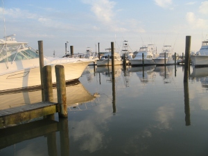
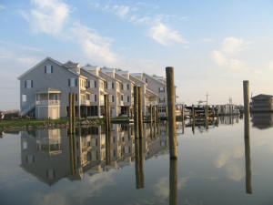
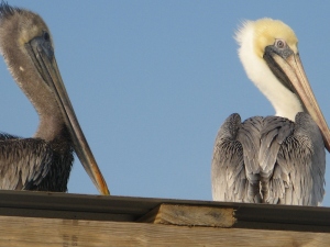
In the meantime, we sit at this beautiful resort. Mike allowed us to plug in and here we spent yesterday afternoon and evening walking around this beautiful resort, and harbor, watching the pelicans play.

This old drake was hanging around and then joined by a blond. I know nothing of pelicans and which is male or female, but that's the way it looked to me.

While out and about I talked to a young guy and asked him about a boat ride. He told me his name was Ryan Buras , a river pilot. "I'd take you myself if I wasn't headed for home," he said, which is Covington. He is 35 years old, was raised in Pilot Town had a house there that was moved off its foundations and deposited in a swamp by Katrina. He now uses his property as a camp, as many pilots who suffered the same fate do. Few of them live there anymore, he told me. He is what is known as a Crescent Pilot, he guides boats in and out of New Orelans. Other pilots work up the Mississippi or their tributaries. To be a pilot you have to have a relative who was a pilot. His grandfather and uncle qualified him. The Pilots's Association building was destroyed by Katrina and they rebuilt in Venice. He hardly ever goes back anymore. The only people who go there are duck hunters and fishermen. His last teacher was an avid duck hunter and if the ducks were in and the wind right, she'd cancel school for the day and go hunting. He knew no other life as a kid, nature, hunting and fishing. He recognized that it was unique to live in a place only accessible by boat.

For information about Pilot Town, click the following url:

en.wikipedia.org/wiki/Pilottown,_Louisiana

Monday, February 22, 2010

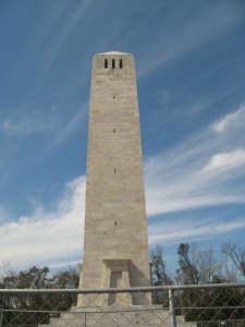
CHALMETTE BATTLEFIELD

The Battle of New Orleans led by Maj. General Andrew Jackson against the British Maj. General Sir Edward Pakenham took place on the Chalmette Plantation just 6 miles south of New Orleans. The “real” war was far removed from New Orleans and was instigated by impressment of sailors, the British fomenting the Indians, and the desire for some Americans to annex parts of British held Canada. The war was moving half-heartedly because Britain was also fighting Napoleon. Once they defeated Napoleon, the British moved battle hardened troops to finish the job and wipe up the Americans. One aim was to take the Port of New Orleans and control access to the interior. In fact a treaty was signed before the battle of New Orleans took place but Pakenham was ordered to keep on fighting until the Treaty was ratified.

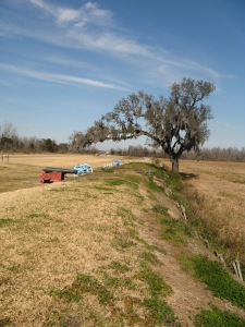
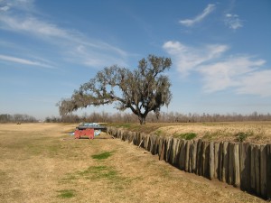
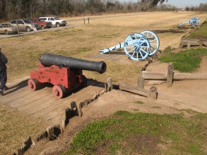
Pakenham had encountered and won several skirmishes leading up to Chalmette, his troops were tired and he proposed to rest. When Jackson found his troops were nearby, they decided to engage them immediately, as night was falling. They stationed themselves behind this small levee formed the Rodriquez Canal from which the plantation watered their crops. Every manuever Pakenham tried was met with heavy fire from American embattlements and in the morning, the American troops were aghast at a sea of red bodies on the opposite side of the canal.

The British dead exceeded 2000, the Americans 18. The battle was a turning point in the war. Britain finally recognized that Americans were a serious challenge and couldn’t be fought so far from home.

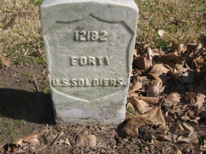
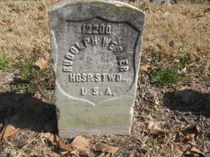
A National Cemetery was dedicated on this battlefield in 1864 for the reinterment of Union Soldiers who died in Civil War Hospitals and were buried in nearby locations. Ultimately, 15,000 veterans of wars on American soil were placed here, over 6,000 of them unknown.

The gravestones reflect the company, infantry, cavalry or other designations of rank and place as in the stone above, hospital steward and below, volunteer infantry from the Spanish American war.

The battlefield was flooded during Katrina and the visitor center destroyed. It is just now being rebuilt as so many places in Louisiana still wait even after five years. We are moving on to other parts of Louisiana and slowing our pace in the days ahead.

Sunday, February 21, 2010

ST. LOUIS CATHEDRAL AND CABILDO

On the 18th and 19th we visited the Cabildo, the St. Louis Cathedral and the 1850 House, all connected in a surround which makes up one end and one side of Jackson Square in the European manner of government. Even small villages in France and Spain were set up in this manner. The church, the offices of government, the communal well, the market, all centrally and efficiently located for people to gather and do business.

The St. Louis Cathedral is the oldest Catholic Church in the United States. Built in 1717, replaced, burned down and the final Cathedral stands on the same spot. The Ursuline Convent, nearby, is believed to be the oldest French building still standing in the Mississippi Valley. Interesting that the Ursulines and Jesuits both had slaves during the Antibellum years. Then later, they took in children of slaves and did many good works. Politics and religion were closely entwined making me grateful our constitutional fathers had the wisdom to separate Church and State.


This beautiful carved wooden hand, fronted by a mothers beautiful face, held the head of the baby to be baptized.


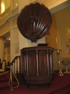
The carved wooden pulpit is also a beautiful work of art as are the stained glass windows that line both sides of the church. Beautiful old world type frescoes cover the ceiling. A must see if you get to New Orleans.


The Cabildo, which is the Spanish word for Government Council, is one of the most comprehensive, thorough and easy to understand museums I've ever visited. Louisiana typically does a great job on their museums and keeps the prices affordable as well. Not all of them have the whirlwind Jimmy Jackson at their service, however. Jimmy gives you the best tour, suggests places to eat to suit your taste (if asked) and made our museum tour extra relevant.

Its tough to give a true feel for the place. It takes you from the early Indians, through the War of 1812, the Civil War and reconstruction. Added to that was a modern Rock and Roll exhibit and a gallery of the years best pictures of 2009 culled to 85 from 55,0000 submitted. I was impressed by the fact that the Indians here so outnumbered the settlers, both French and Spanish, that they could compete with the intruders. They held tightly to the secrets of their medicinal herbs and bartered using the knowledge of food plants, the land, the swamps, and weather. All the settlers failed at growing wheat and embraced the local food of the Indians. Only later did they turn to rice and sugar and tobacco. The photo above is playing cards used in place of hard currency. Readily available, one card equaled about 12 cents.


And, as always, appalled at man's inhumanity to man. Above is a slave collar with bells. They would fill the bells with mud to hide their movements. The slaves, despite their servitude, managed as best they could, some sense of community and family. That is here too. In fact, the records indicate that more slaves and free people of color attended church, were baptized, married and participated than the settlers.


The Louisiana purchase, signing the papers for transfer from the Spain, to France to the United State is covered fully here. The papers were signed in this building. The Battle of New Orleans is also comprehensively covered. Don't miss this museum when you visit. The picture above is one of thousands of bottles used to mark the borders of the Louisiana Purchase. Survey notes were sealed inside and the bottles were buried in huge heaps to mark their spot. Not all of them were recovered and could still be out there waiting for somebody to find.

Saturday, February 20, 2010

LOUISIANA MINT, ST. LOUIS CEMETERY AND A LAUNDROMAT

Just inside the door of the historic Louisiana Mint, you see a picture of a lovely young woman, Josephine, the daughter of the mint’s first administrator. I would never have thought that he and his family had quarters in the building. When his daughter’s had their coming out parties, all the leading citizens were guests inside the Mint. Not that they were sitting on top of piles of money, or anything. Guards stayed at the door during family parties. It gave a charming touch of humanity to the staid subject of making money.

And, I was surprised to learn that women worked at the mint. They examined, weighed and filed the edges of coins that were overweight while sitting in chairs with leather aprons attached to the table so not to lose one bit of precious silver dust. In minting money, it was thought some tasks were better performed by the small hands and delicate touch of women. Good for them!

This calculator called The Millionaire could calculate to the millions, an awesome sum in the days when bread was 5 cents a loaf.

No matter how you look at it, money is heavy stuff and it required a steel wheeled cart to move it around the building in strongly constructed wooden boxes. First made into placques, then given an edge, then stamped on each side. All coins were made individually at first.

The mint was actually commissioned by President Andrew Jackson because hard currency was needed in the area for building the west. Again, coin is heavy and must be safely transported to where it is needed. In later years, the machine above could put out thousands of coins per hour. It rolled the edge and stamped both sides at once with 200 tons of pressure. I guess that’s why they call it hard currency.

Louisiana’s government decided to secede from the Union and joined the Confederate States of America. They took over the coining of money for a short time until the Civil War put the mint back in the hands of the United States. The Louisiana Mint was the only one to produce Confederate Currency.It closed in 1909.

Next, we visited the oldest Cemetery in New Orleans, St. Louis Cemetery No. 1. Graves here are above ground because the water table is so low. The crypts are broken open when another family member dies and desiccated corpses are moved from their drying “beds” to make room for succeeding generations. That way, they can hold many generations. Some crypts, like the one below, are burial places of honor for people who belonged to a particular group, such as Nuns or Priests of the same parish. This old cemetery has been ravaged by weather and many

of the crypts are being refurbished.

The best kept crypts are those surrounded by a sturdy fence which suggests the graves here have been vandalized over the years.


This bouquet of roses and a heartfelt valentine were taped to this stone from a tearful husband to his beloved wife.

The movie, Easy Rider, used this particular crypt for a movie scene without asking permission of the Arch Diocese. When the movie came out, people who knew this place were aghast at the disrespect shown. New rules were penned forbidding any such activity in a Catholic Cemetery.

We moved on to a very special laundromat on the corner of Ramparts and Dumaine. Roomy and comfortable with benches, tables and chairs, a juke box and a stained glass window. You might be inspired to get up and rock and roll while your clothes are washing. The reason we came to see this unique place is because the history and pictures of great musicians like Fats Domino, Jerry Lee Lewis, Ray Charles, and others line the walls of this former recording studio.

At one time black musicians were not allowed to record in Louisiana. Most went to a Texas studio. One Louisiana official woke up as he watched all that money going to Texas. However, New Orleans musicians used secret little studios in the back of someone’s garage or in a corner of a restaurant after hours.

Lloyd Price, above, was one of the musicians that Cosimo Matassa accepted into his recording studio. The placque below is on the building.